Maps are a really important part of our business. We use them in our apps, audio trails and activity packs to help guide visitors from one place to the next, or locate a specific place of interest.
Digital or traditional maps?
We create maps on computers or with a pencil and paint (which can be scanned to create a digital copy). Exactly what your map will look like in the end is up to you. Below are some examples to illustrate previous work for clients.
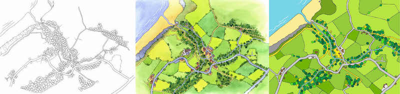
These examples also illustrate that your map can be oblique/3D (left and centre) or plan view (right).
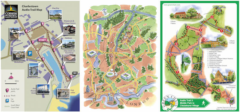
We also add illustrative maps to our apps as an offline resource. This means that even if the app user has no reception our geo-referenced maps will allow visitors to explore the key areas that your app covers. Illustrative maps also allow you to determine which features to include/exclude from the map.
Remember foreign visitors often turn off their data to prevent roaming charges. In this instance offline maps will still work perfectly.
Useful online mapping tools
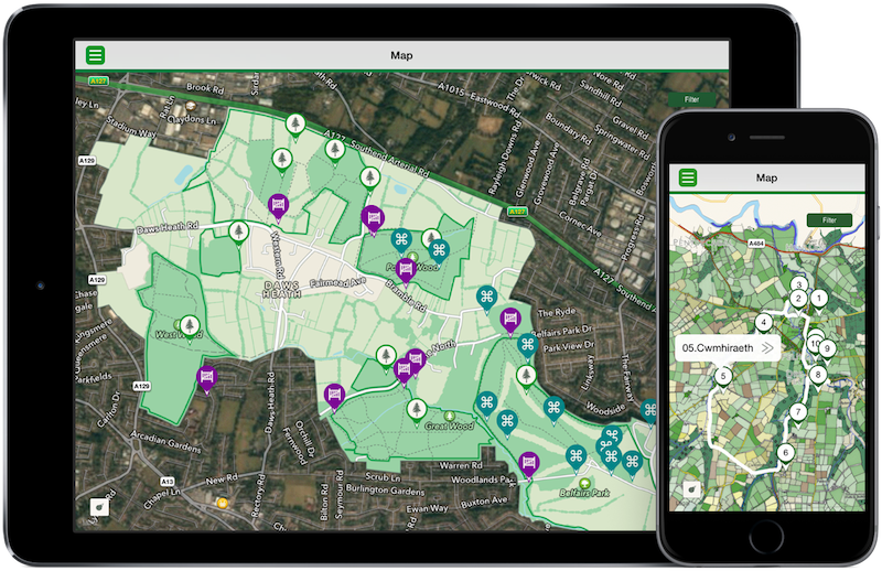
Maps help us to create fantastic experiences too. We use a range of maps – both paper-based and digital – to base our research on and build our projects.
Interactive
Below are links to some useful mapping websites that you may find useful:
National Library of Scotland – fade old maps over modern ones (UK wide) to see how places have changed – be prepared to waste many hours pouring over this site!!
WTracks – a tool we use all the time to edit gpx files online
Radius around a point – use this tool to find the radius around a point on the map – great for figuring out trigger radius for app places of interest
Get a Map – Enter a placename, grid ref or postcode and view it on digital Ordnance Survey mapping
Google Maps – everyone knows this one, but that shouldn’t mean we exclude it from the list – it’s brilliant!
For converting to and from lat/longs and grid refs or file formats:
– fcc.gov
– gpsvisualizer.com – great for converting GPX files and similar
We are always looking for good online mapping tools. Do you know any other good sites we should include on this list? Please get in touch if you do.