Although I only live a 10 minute drive from the start of the High Peak Trail, I have never travelled its full length. In fact I realised there are some sections that I had never visited. It’s also longer than I thought too!
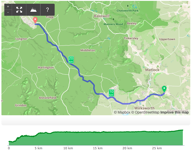
The High Peak Trail follows the route of the former Cromford and High Peak Railway that connected the Cromford and Peak Forest canals. It starts at High Peak Junction before heading steeply uphill – a rise of 300m over the first 7km.
This eastern end is a section I am very familiar with and it features in one of the trails on our free Discover Derbyshire & Peak District app – the Cromford Heritage Trail – it includes plenty of information about the railway and Sir Richard Arkwright – pioneer of the modern factory system. In fact, just a few weeks back I visited Cromford Mill.
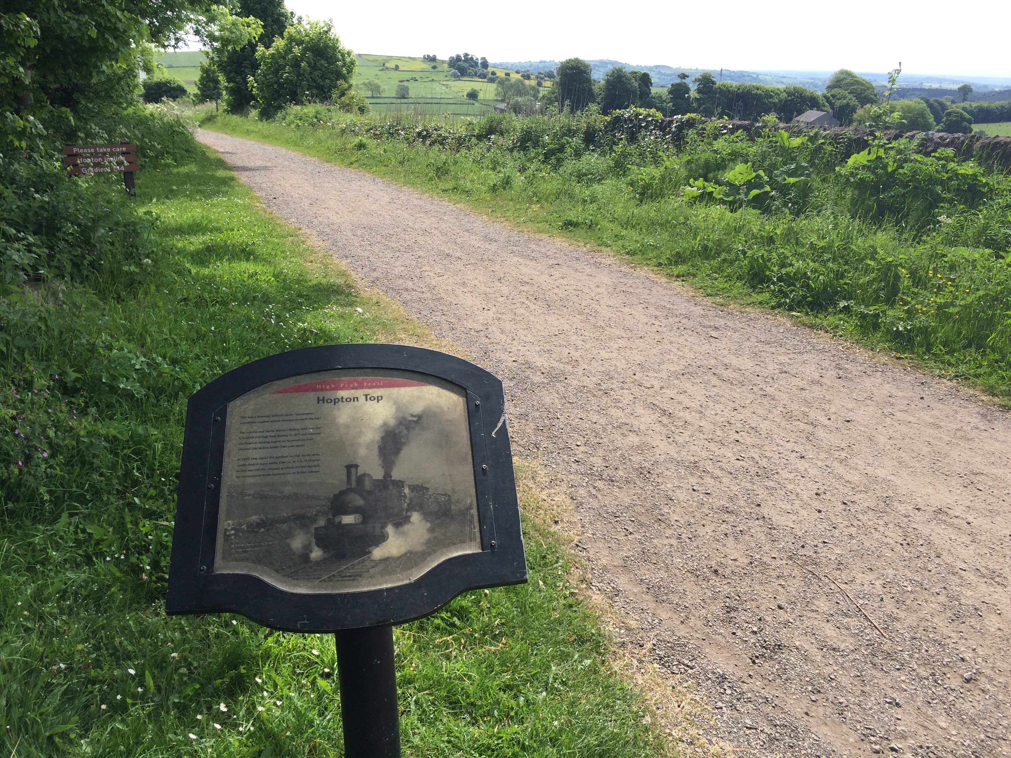
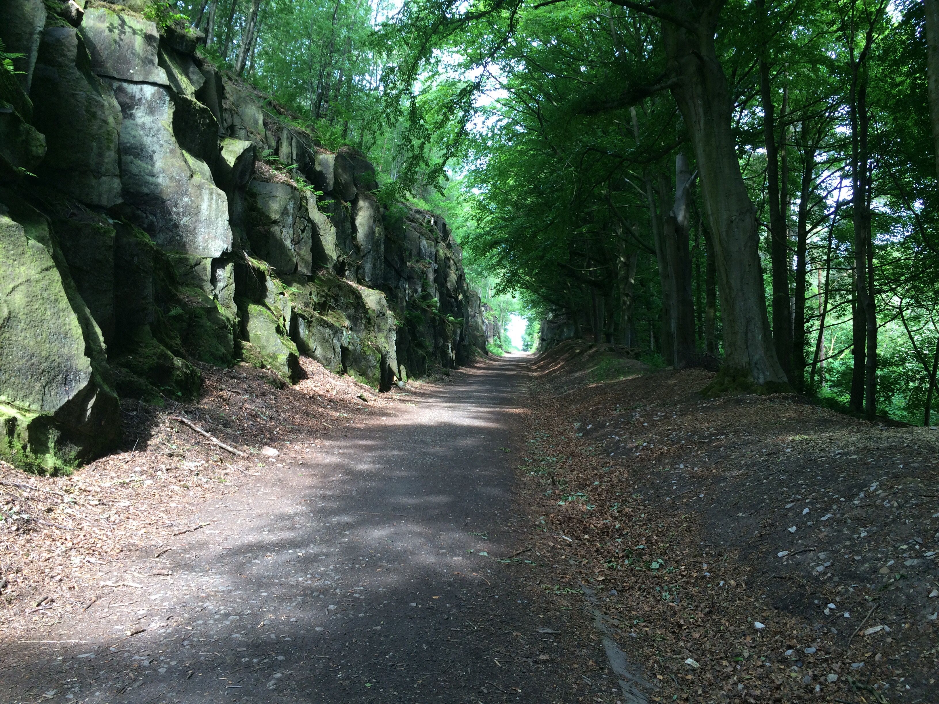
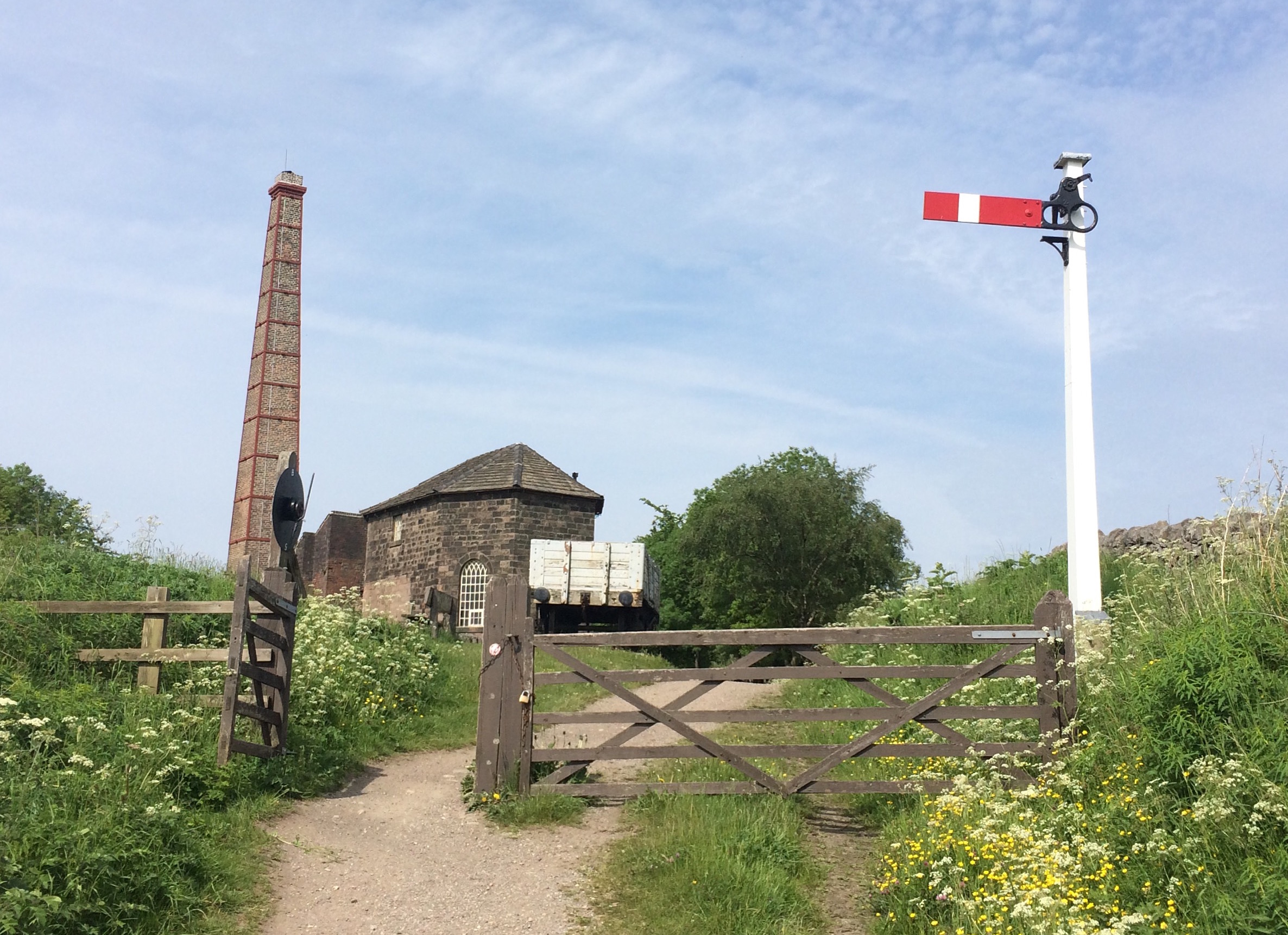
The whole 28.5km (17.7 mile) trail is well catered for with tired, but robust and informative panels mainly focussed on the railway and quarrying industry. However, there are many other stories and points of interest along the trail and three caught my eye in quick succession after passing Middleton Top.
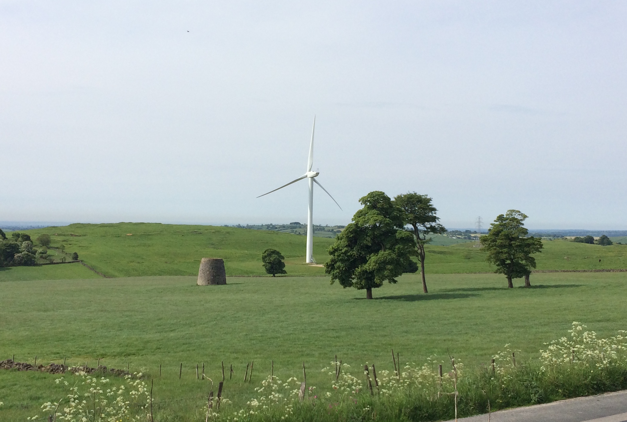
Just before Hopton Top, the last of the three steepest inclines – and a new section to me – I was grabbed by a view to my left. The remains of an old stone windmill stood in the shadow of a modern day wind turbine. The wind was little use for generating electricity or grinding corn today, but perfect for cycling, especially as the clouds had lightly dulled the intense sunlight of the day before.
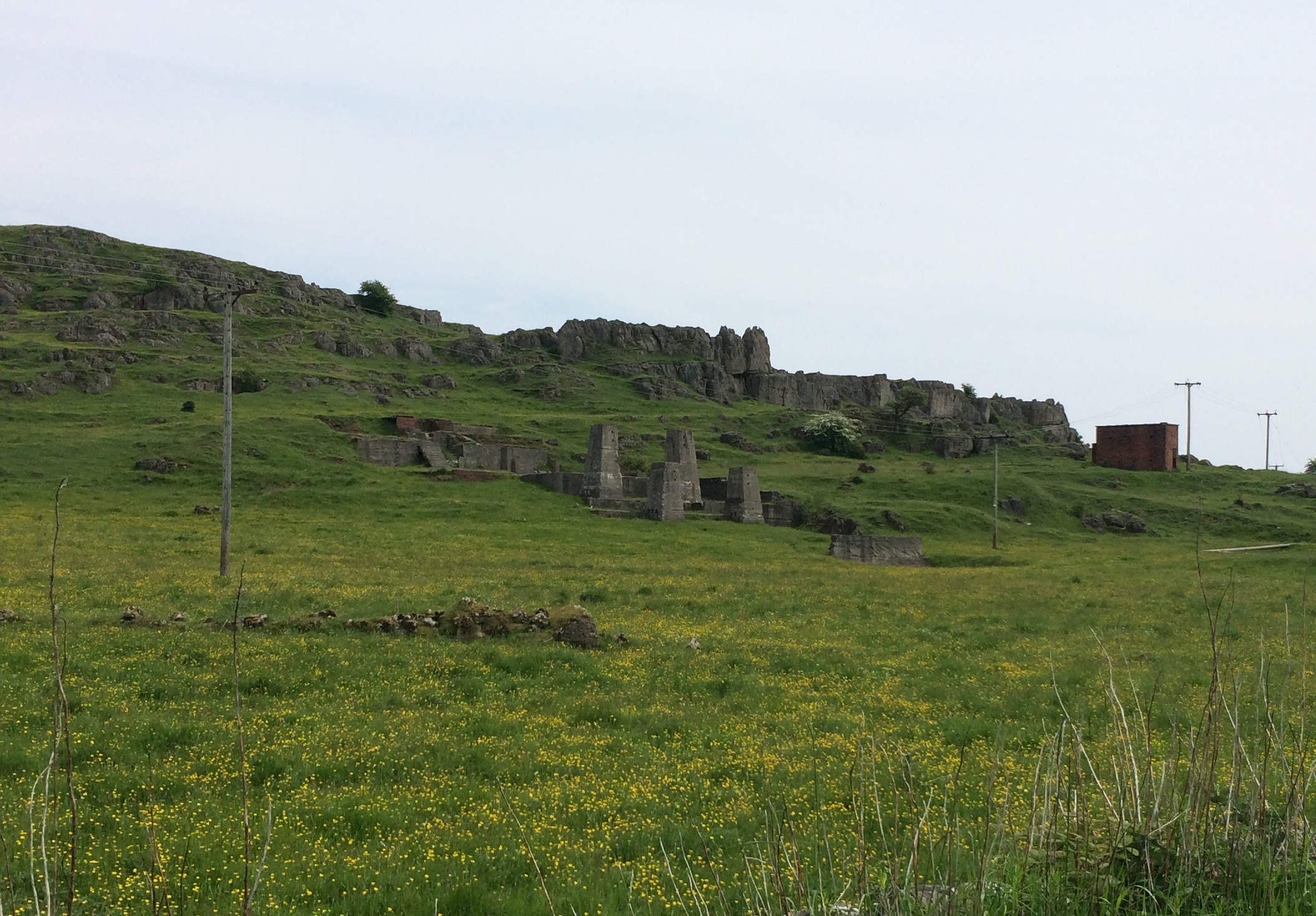
Shortly afterwards I passed four Inca-like stone pillars, plus other remnants of past industry, on my right. I knew about this site near Harborough Rocks but again had never seen it. Here lead ore was once crushed. The sound would have been deafening, if the audio trails we did about similar industries in Cornwall (tin mining) and Coed y Brenin (copper mining) are anything to go by. Some interpretation here could really bring the site to life.
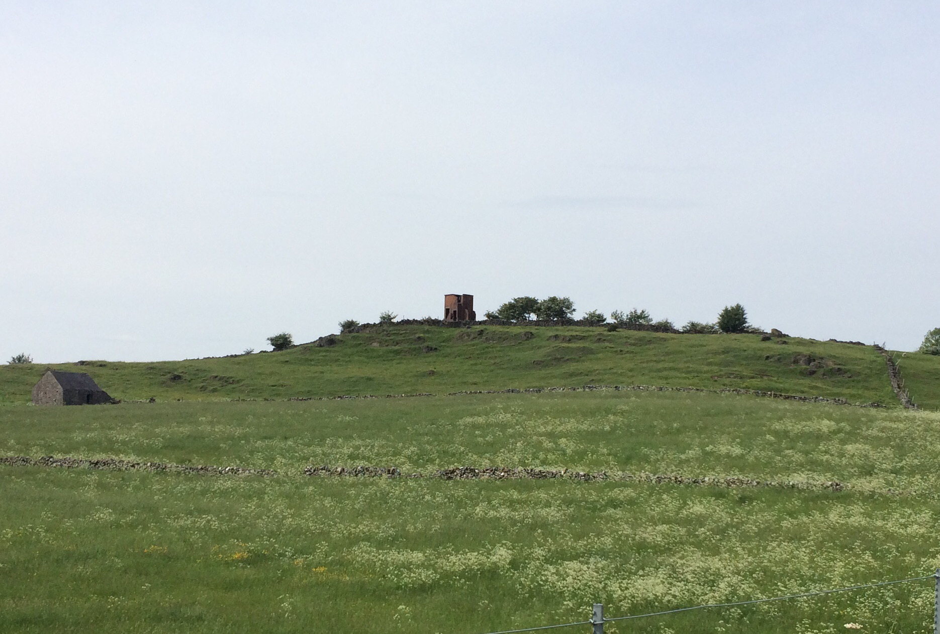
The third feature to catch my eye – a red brick structure – stood on the skyline near Longcliffe. Fortunately, a Derbyshire County Council truck was just round the corner and the driver told me it was an observation tower from WWII. Nothing along the trail provides this information.
By the time I had reached Minninglow I was back in familiar territory. The Royston Grange trail on the Discover Derbyshire app again uses part of the High Peak Trail and reveals a rich and varied history of this area from monks to Victorian railwaymen.
The rest of my ride was full of wonderful views, dry stone walls, plenty of wildflowers, birds and livestock, plus exposed rocks – the result of cuttings being blasted through the limestone for the former railway. I also spent time trying to put into practise what I had read in Tristan Gooley’s excellent ‘The Walker’s Guide to Outdoor Clues and Signs’. It’s basically a book that gives you tips on how to use nature to help you navigate. It’s how all of our ancestors did it before maps, compasses and GPS – and how some still travel today.
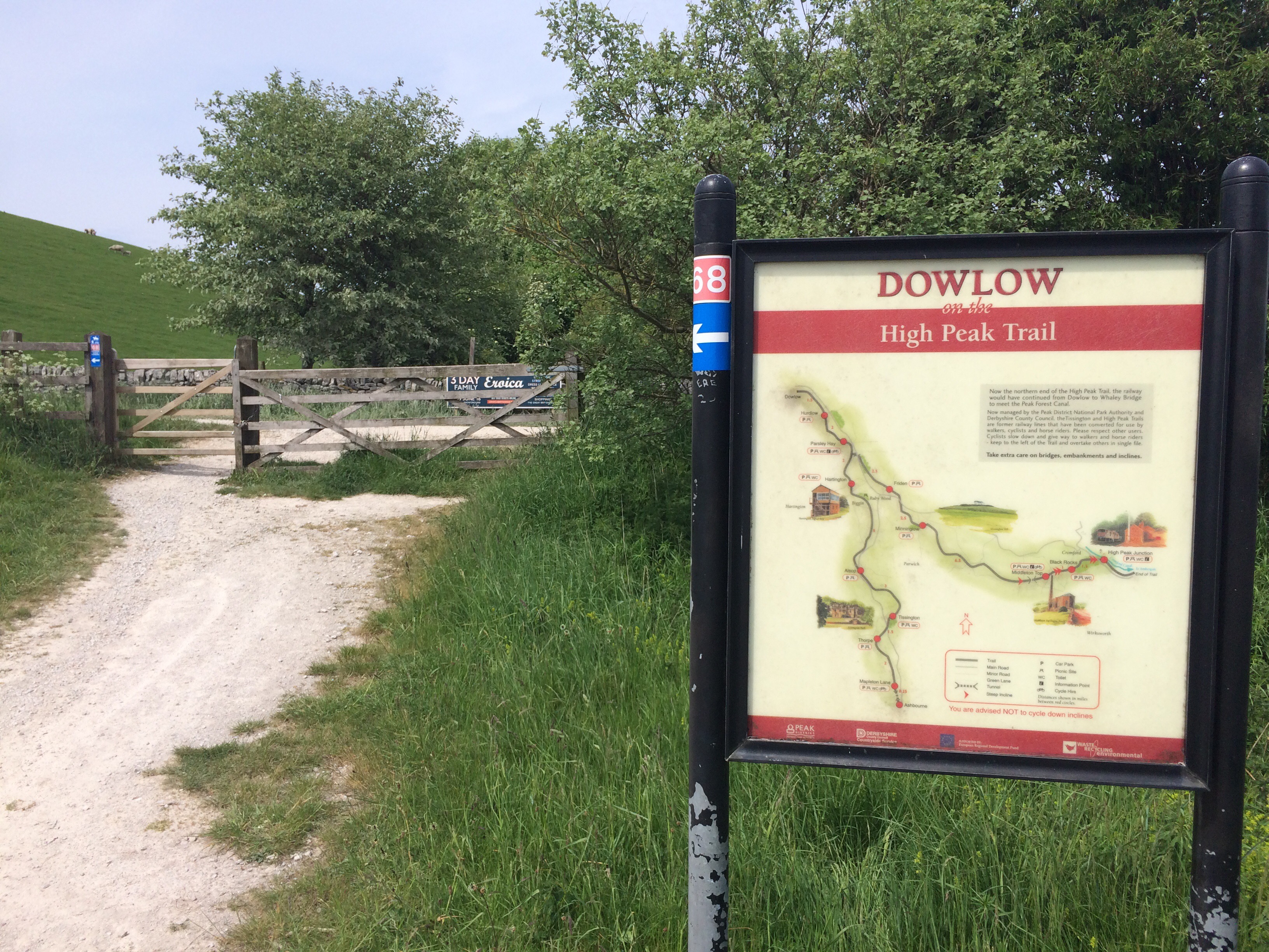
I had always thought the High Peak Trail’s western end was at Hurdlow, but in fact it continues for a further 2km to the eastern edge of Dowlow Quarry, and just as I arrived a huge blast confirmed this fact. I know the area just south east of here very well. In February we stayed at Wheeldon Trees Farm in return for writing a trail for the Discover Derbyshire app. This one – Earl Sterndale – takes in the wonderful Dragon’s Back and Derbyshire’s answer to the pyramids. It’s a wonderful walk.
On my return I stopped at Parsley Hay, the most populated part of the trail by far. Snickers, Mars Bars and Twix were a pound each, which I thought was a bit steep. I instead plumped for a £1.80 flapjack. Again, over-inflated prices (a jacket potato was only £3.50), but it was a decent size and tasted lovely.
Had I had more time I would have ventured down the Tissington Trail (which celebrated its 45th birthday last week) from this point and taken a route along the northern edge of Carsington Water, but I’ll save that for another day.
Today it was just lovely to cross, traffic-free, from one side of the Peak District to the other and imagine all those that had done the same over the centuries. Railway lines past and present offer a seamless link through towns, cites and countryside. My kids now always say, “Let me guess we are on an old railway line.” We usually are. In February I walked the London Victoria Underground line, overground. Next week its the turn of the Central Line, but only the central section. Whether on foot, bike or train these routes always take you on a fascinating journey of discovery.